Local weather

Loading NWS weather for Charlotte…
Weather mapsGenerated graphics

Checking local weather alerts…

Current conditionsConnecting to NWS…

Charlotte

—°F

Connecting to the National Weather Service

Live observations and official forecasts

Wind
—
Wind gust
—
Dew point
—
Humidity
—
Visibility
—
Pressure
—

NWS weather station

NWS observations
PRECIPITATION AMOUNTSNWS FORECAST
Liquid equivalent—
Snowfall—
Ice—

Next 24 hours

Approximate totals; partial forecast intervals are prorated. Snow is accumulation, not snow probability. Loading forecast amounts…

DAYLIGHT
Sunrise—
Sunset—

Calculated for your selected location

Hourly forecast

Select an hour for conditions, wind, and precipitation.

NWS forecast
WHAT TO EXPECT

Your hourly temperature and precipitation forecast is loading.

TemperaturePrecipitation chance

7-day forecast

Select a day for the full forecast.

Weather graphics

Severe weather, rainfall, surface analyses and tropical forecasts. View, share and download.

Browse graphics

Weather maps

Explore severe weather, rainfall, temperatures, and the tropics.

Open Weather Web
NOAA / STORM PREDICTION CENTER

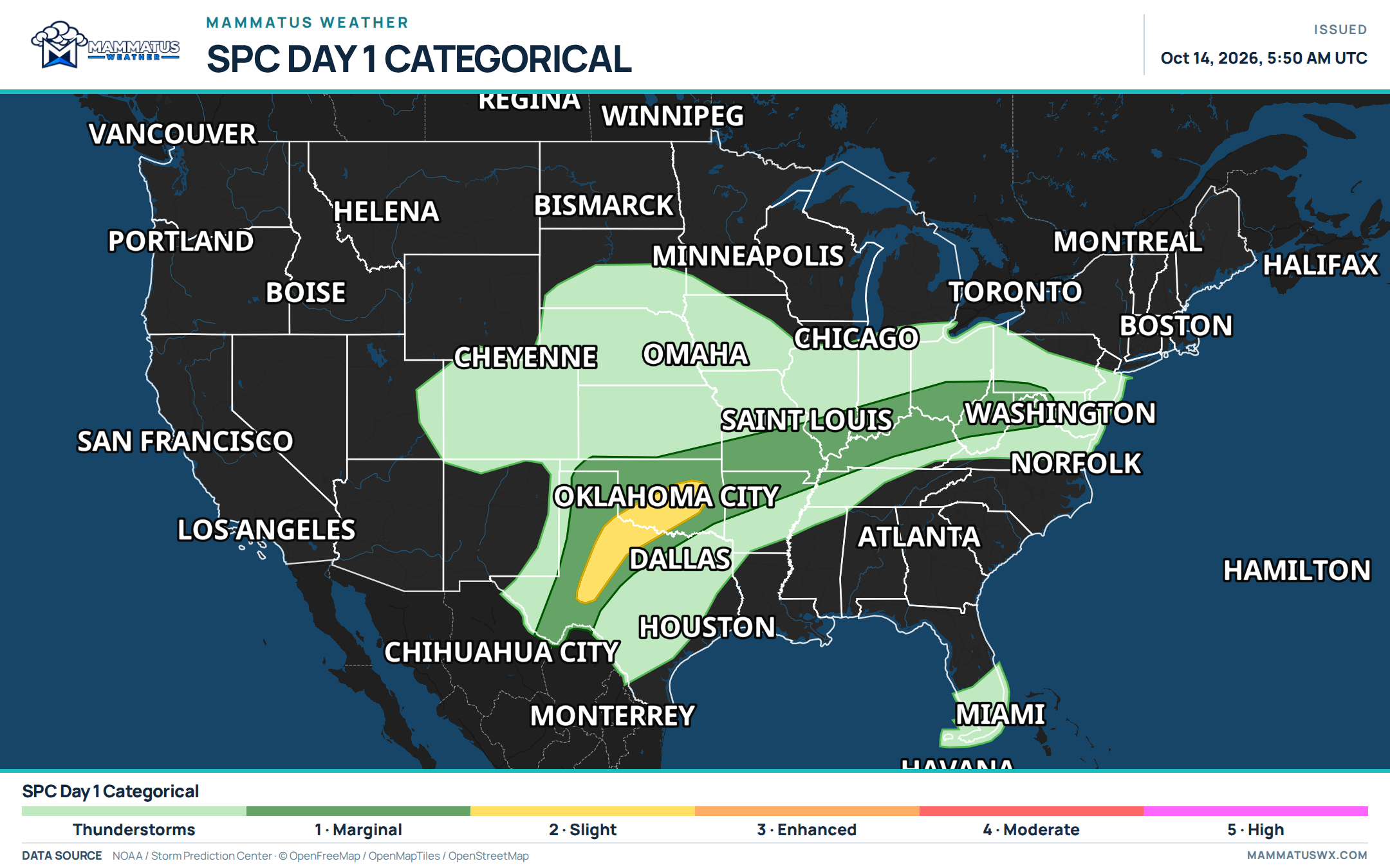
Day 1 categorical outlook

Loading official weather data…
How to read this map

The categorical outlook describes the risk of organized severe thunderstorms. Higher categories indicate greater coverage or intensity, not a guarantee of storms at your location.

Read the official outlook ↗

Weather guide

SEVERE WEATHER

Outlooks, watches, and warnings

SPC outlooks identify where severe storms may develop. A watch means conditions are favorable. A warning means severe weather is occurring or imminent—follow the instructions from your local National Weather Service office.

Know the difference ↗
FLOODING

Excessive rainfall outlooks

WPC’s excessive rainfall outlook highlights where rainfall could cause flash flooding. It accounts for how much rain may fall and how vulnerable the ground is. Never drive into floodwater, even on a familiar road.

Read the rainfall outlook ↗
TEMPERATURE

Surface temperature analysis

The RTMA temperature map combines observations with weather models to analyze conditions near the surface. City values come from the same analysis. Check its valid time: observations, analyses, and forecasts each tell a different part of the story.


About the analysis ↗

Mammatus for iPhone

Radar, satellite, local forecasts, and severe weather tools in the Mammatus Weather app.

Free to download · Built for iPhone
Mammatus Weather app icon

YOUR WORLD, YOUR WEATHER

Find your forecast.

Choose a U.S. city for NWS conditions, forecasts, and alerts.

Location is requested with your browser’s permission. Your selection and up to four recent locations are saved on this device. Coordinates are sent to our weather service to request NWS data; they aren’t stored in a location database.